It’s most inappropriate to nail notices to magnificent Eucalypts like this one. Even so, there is something poetic about this sign on a back road from Oberon to Taralga, deep in the south-western part of the Blue Mountains Conservation Society’s Area of Interest. A little collection of farmlets, seemingly struggling wineries and a motor cycle park dot the sections of this road that are not lined by part of the Blue Mountains National Park.
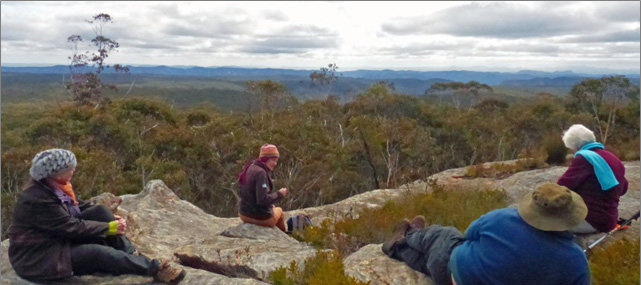
Mountains most spectacular lookouts. A trig and sandstone outcrops, showing some visitation by careless picnickers, rise to the north of the four-wheel-drive route.
On clear days, the Eucalypt forests can be seen sweeping sharply down towards the main valley of the Wolgan. Escarpment features like Cape Horn and the brow of Donkey Mountain punctuate the middle ground. You can see over much of the ridge west of the Wolgan to the crests of Pantoneys Crown, Mount Genowlan and Mount Tayan.
On the way there one passes areas of the plateau much affected by Angus Place and other collieries. It is to be hoped oases like the Bird Rock Reserve inspire the long- term preservation and, where necessary, revegetation of Newnes Plateau.
The mid 1970’s was a pivotal era for the beautiful Boyd Plateau, now part of the Kanangra-Boyd Wilderness Area. A proposal emerged for a 2000 hectare pine plantation which would have destroyed the last sub-alpine forest in Central NSW (source: Colong Foundation website). After a public campaign, investigations by the State Pollution Control Commission, with input from the Colong Foundation, led to the sparing of the native forest in 1975.
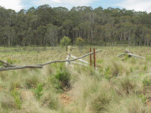
A wombat lives where the forest is reinvading the pasture.
In 1994, as the National Parks and Wildlife Service sought to buy out agricultural inholdings on the Plateau, the Upper Blue Mountains Conservation Society, a predecessor to Blue Mountains Conservation Society, made a major financial contribution.
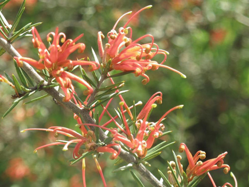
The Red Grevilleas are popular with both birds and pollinating insects, in the old inholding.
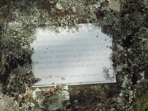
Today the integration of the Budthingaroo pastoral lands into the surrounding forest is gradually continuing. Lichen encrusts the small plaque about 300 metres from the Kanangra Walls Road which acknowledges the Society’s donation. Red Grevillea plants and many other natives dot the remaining pastures.
The Society’s 1994 contribution recorded in stone: “Development in this portion of land within the Park was averted with the assistance of the Upper Blue Mountains Conservation Society. Returning the land to its natural condition satisfies one of the Society’s long held goals. Tread softly for we are but passers by.”
On a recent visit, Society members disturbed mobs of Eastern Grey Kangaroos, observed migrating white butterflies, and trod carefully around a newly dug wombat burrow. It was a time to feel truly grateful to the past activists from Upper Blue Mountains Conservation Society and the Colong Foundation as well as the officers from National Parks and other state government bodies who envisaged an intact wilderness surviving for generations on the plateau.
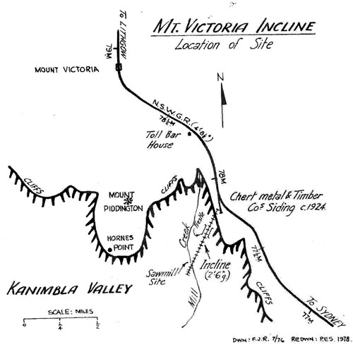
Nestling in the typical Blue Mountains ridge Eucalypt forest south of Mount Victoria are the remnants of a most unusual industrial operation. From 1925 to 1930 an incline railway operated to a main line siding from the valley, carrying timber and the rock known as chert. (Source: F. John Reid, article in “Light Railways”, January 1979.)
The entire enterprise was never as successful as hoped and the operation changed owners at least once during the few years before its abandonment.
Location of Site sketch from “‘Chert’ Incline, Mt Victoria, NSW” by F John Reid]
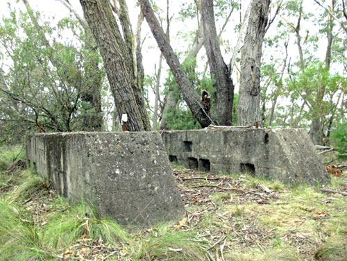
The archaeological site represented by the old siding and incline head station is now on a publicly accessible walking track from Fairy Bower picnic area at Mount Victoria along the western side of the railway to the north end of Station Street Blackheath. Apart from the concrete blocks (pictured) you can still see a number of old items from the 1920s lying about if you look carefully.
In the 1980s, Jim Smith and the late Wilf Hilder re-established a walking track from Fairy Bower picnic area to the bottom station, deep in the valley west of Mill Creek. This area proved particularly rich in relics such as old skips as well as chert and timber that was never loaded. They named the track “The Kinderin Track”, taking a local indigenous word.
It is sobering, even now, to think that this rich lode of a resource, respected by the traditional owners, was so messily and unsuccessfully disrupted.