Blue Trail 16: Former Brewery Subdivision, Oakey Park

Richard Inch and his brother converted Mort’s old meatworks to the Blue Mountains Brewery during the years 1902 to 1904. The pockets of development around Lithgow contain a number of distinctive styles of housing which were largely occupied by manual workers engaged in the various industrial and mining enterprises which have defined Lithgow’s history. Few are as picturesque as the brick and stone cottages in Bragg and Brisbane Streets, near the brewery in Oakey Park. 

Oakey Park houses framed by pagoda studded ridges (Christine Davies)

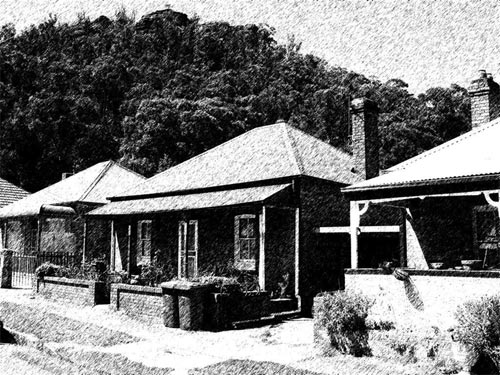
They are mainly single storey, with an occasional upper storey. A few have original looking verandahs. The size of the windows and the thickness of the walls attest to the severity of the winters. Elaborate and ornate chimneys survive on some of the cottages. The numerous watercourses through the subdivision have never been piped and the riparian vegetation and old wooden foot bridges are a feature of the area. 

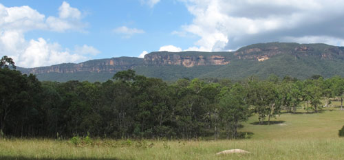
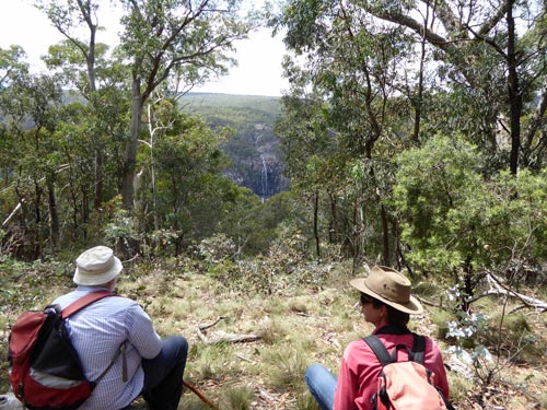
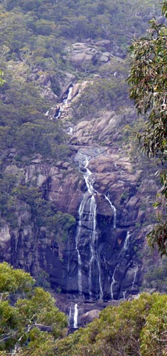
Contributing to the visual spectacle are the rings of hills, cliff-faces and pagodas surrounding the elongated Lithgow basin. It is hidden treasures like this which make Lithgow a photographer’s paradise. 

© Don Morison

Blue Trail 15: Stile Country, Central Megalong Creek Catchment

Narrowneck cliff-face and clouds from Six Foot Track (photo: Christine Davies)

The “Six Foot Track” was a bridle track cut in 1884 to a specified width to allow tourist horse riders between Katoomba and Jenolan Caves. Now it is one of the most popular of the longer walks in the Greater Blue Mountains. 

Where it crosses private property, east of Megalong cemetery, a series of stiles take walkers across the fence lines. The lack of cars and off-road vehicles make this one of the most attractive sections of the track. Eastern Grey Kangaroos and various wallaby species are often seen. Many old trees have been left undisturbed on these agricultural lands, including large Angophora floribunda, Eucalyptus punctata and other species of the Myrtaceae family. 

A woman with stile (photo: Don Morison)

The countryside undulates gently. The going for walkers is fairly easy except when substantial rains turn the normally tame watercourses into frothing torrents. The mixture of agricultural land and woodlands attracts a variety of birds including flocks of White-winged Choughs. 

This trail section is one of the best vantage points to view the unspoilt cliffs of Narrowneck Plateau, a short distance to the south.

© Don Morison

BLUE TRAIL 14: CLASSICALLY CLOSETED, MOUNT VICTORIA

Throne room in Imperial Hotel, Mount Victoria

When one bushwalks, all of one’s bodily essences are stirred. So it is comforting to find Thomas Krapper’s invention, the water closet, at a location of convenience. The depicted example (of 1900-1910 vintage) in the Men’s at Mount Victoria’s Imperial Hotel is possibly the oldest functioning water closet in Australia. 

Even so, it is not the only auspicious facility in the town. The entrance to the Ladies’ in the park opposite is flanked by a Henry Lawson mural. Fortunately the Lawson poem used is about a Mount Victoria local legend, not his 1892 poem: “The Queen has reigned for 50 years, for 50 years and 5, she’s yet to do just one good turn to anyone alive!” 

Because … this township of tasteful toilets was named after the ruler of the British Empire while she was still Princess Victoria. It’s important that the amenities block decorations do not disparage said sovereign. If a time machine allowed Victoria to travel to her Australian tourist town in 2016, her majesty might not be amused. But she could certainly be fittingly enthroned!

Henry Lawson was a true “ladies” man


© Don Morison

Blue Trail 13: MORONG VIEW RIDGE, UPPER KOWMUNG CATCHMENT 

In the south-west section of Blue Mountains National Park, a high ridge offers a view of the distinctive Morong Falls. 

Viewing point for Morong Falls (image: Sue Nicol)

A red-necked wallaby, a goanna and a snake – possibly a copperhead – crossed our path as we traversed the vehicular track between the National Park boundary and Morong Falls Lookout. 

700 metres before the lookout we came upon a narrow ridge peppered with lichen-encrusted granite boulders and the air was perfumed with the scent of the dominant Eucalypts. The vehicular track plunged steeply through 100 metres of loose rocks and gravel, causing us to park the four wheel drives and walk. 

Granite outcrop, SW Blue Mountains NP (image: Christine Davies)

The diverse vegetation provided a plant identification challenge as the descent flattened out and we surmounted one more little knoll before reaching an inspiring panorama centred on the spindly streams of Morong Falls whispering their way into the “Morong Deep” section of the Upper Kowmung River. 

© Don Morison

the unique patterns of the multiple watercourses of Morong Falls (image: Sue Nicol)