BLUE TRAIL 23: OLD POST OFFICE AND GRANITE COUNTRY, Hartley

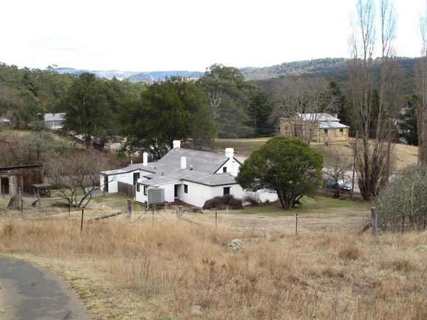
The beautiful old Post Office at Hartley was constructed in the 1840s when this village was one of the most important settlements on the western road from Emu Plains to Bathurst. Its significance declined when bypassed by the first railway in 1869. Later the National Parks and Wildlife Service was able to take over the site and protect the 19th century features. 

The old Post Office and Court House (background) define the 19th century dignity of Hartley [photo: © Christine Davies]
In the Greater Blue Mountains, well preserved natural landscapes based on sandstones, shales, limestones and marbles are prominent. Our granite landscapes have been mostly transformed by agriculture, Evans Crown Nature Reserve is a rare exception. 

Gerard from Lithgow explores the Kew-y-ahn Heritage Walk (published by kind permission of Gerard’s mother) [photo: © Christine Davies]
Much as it has been influenced by human activities, the granite zone around Old Hartley Post Office remains impressive. In 2013, NPWS opened the Kew-y-ahn Heritage Walk, a short trail giving access to a prominent granite outcrop above the village. The Post Office building itself is now a well patronised café, offering both snacks and lunches. Development of walking tracks to allow better appreciation of the overall site continues. 

© Don Morison

Kew-y-ahn (or Bell Rock) outcrop, above Hartley Village [photo: © Christine Davies]

Blue Trail 50:   Oberon Dam

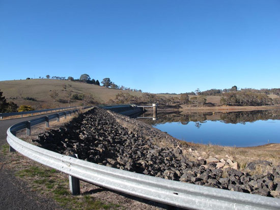
Oberon Dam, built in two stages between 1943 and 1959 across the waterway now known as the Fish River, is 232 metres long and 35 metres high.  The surface area of the water it holds when full is 410 hectares.  It was originally built to supply water to the Glen Davis shale oil refinery and industries around Lithgow as well as the supporting population.  It now feeds water into areas served by the Sydney Catchment Authority, largely through a pipeline which conveys water to the base of the geological formation known as First Narrowneck, a short distance south of Katoomba township. 

The sparse native tree cover and the structures of Oberon dam are reflected in the captured waters of the Fish River [© Don Morison]
A short bushwalk off the Narrowneck fire trail allows you to hear the pumps working to lift the water from the floor of the Megalong Valley up into a system that lets it serve reservoirs in the upper mountains towns.  Until a few years ago, maintenance ladders known as “Dixons Ladders” paralleled the pipe rising against the cliff at Narrowneck.  Excessive adventurousness by some bushwalkers convinced the NPWS to remove the ladders.

The colours of deciduous exotics face a patch of Eucalypts on an autumn drive to Oberon dam. [© Don Morison]
A brief but pleasant drive takes the visitor from the Oberon Tourist Information Centre to the picnic area below the dam wall.  In autumn, the deciduous trees along the route offer a colourful display and there is a small patch of moderately disturbed natural bushland along the entry road.  You can walk along the dam wall but there is only limited access to the lake foreshores on either side.  This is one of several access points to the catchment lake which features in the popularity of the Oberon district for fishing.  

© Don Morison


Blue Trail 48: BRACEY’S LOOKOUT, Hassans Walls Plateau

The Hassans Walls Plateau, named by Governor Lachlan Macquarie in 1813 for its similarity to landforms in northern India, offers an eclectic selection of Blue Mountains scenery.

A curtain of Exocarpos cupressiformis (Native Cherry) on the slope north of the lookout [photo © Christine Davies]
In Hassans Walls (according to Col Bembrick in Coxs Road Dreaming 2015), we have a sandstone plateau rising above Permian deposits.  Many of the formations appear as outliers of the pagodas and other sandstone structures which characterise the Gardens of Stone district, one reason that Hassans Walls has been recommended to be included in Gardens of Stone reserved area Stage 2.

Pagodas, outliers of the many thousands of such formations found in existing reserved areas of the Gardens of Stone and proposed extensions.
[photo © Christine Davies]
Across the totality of Hassans Walls, there is evidence of major damage to surface features by now defunct underground coal mines but the area around Bracey’s Lookout (in the north-east of the plateau), is by no means the worst affected.  Bracey’s Lookout is connected to the Pottery Estate precinct within the Lithgow urban area by a steep foot track of only a few hundred metres but it is a dead end of more than two kilometres for motor vehicle access.  It is very popular with bushwalkers, dog walkers and cyclists.

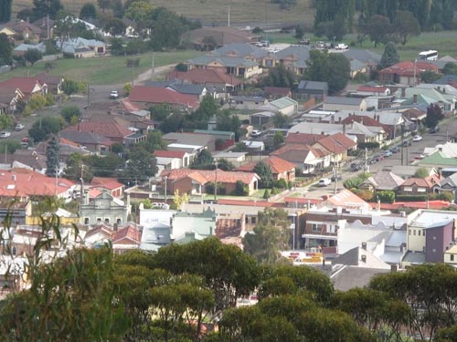
The lookout offers one of the best overviews of the Lithgow urban area including the central business district, evoking memories of the Inch brothers, Pillans and the Bracey family themselves.

The section of Lithgow CBD containing the former Bracey’s Department Store, looking north from the lookout.
[photo © Christine Davies]
Horace and Alice Bracey arrived in Lithgow in 1886 and set up a retailing business in Excelsior Arcade.  Horace became Mayor in the 1890s and the business continued under his descendants, eventually ceasing trade in 2007 by which time it was operating in a substantial purpose-built department store in Main Street.  Generations of the Bracey family yielded some of the most outstanding philanthropists in Lithgow’s history, especially in meeting the cost of developing Hassans Walls for public recreation and appreciation of nature.

Inch Street (named after the founders of Lithgow Brewery), a north-eastern view from the lookout; a corner of Lake Pillans Reserve, named after another former mayor, is visible at the far right.
[photo © Christine Davies]

© Don Morison

Blue Trail 15: Stile Country, Central Megalong Creek Catchment

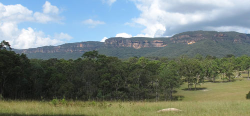
Narrowneck cliff-face and clouds from Six Foot Track (photo: Christine Davies)

The “Six Foot Track” was a bridle track cut in 1884 to a specified width to allow tourist horse riders between Katoomba and Jenolan Caves. Now it is one of the most popular of the longer walks in the Greater Blue Mountains. 

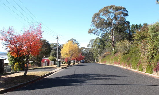
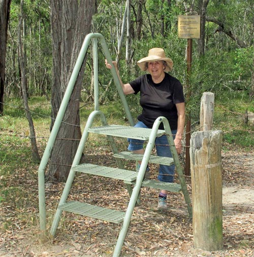
Where it crosses private property, east of Megalong cemetery, a series of stiles take walkers across the fence lines. The lack of cars and off-road vehicles make this one of the most attractive sections of the track. Eastern Grey Kangaroos and various wallaby species are often seen. Many old trees have been left undisturbed on these agricultural lands, including large Angophora floribunda, Eucalyptus punctata and other species of the Myrtaceae family. 

A woman with stile (photo: Don Morison)

The countryside undulates gently. The going for walkers is fairly easy except when substantial rains turn the normally tame watercourses into frothing torrents. The mixture of agricultural land and woodlands attracts a variety of birds including flocks of White-winged Choughs. 

This trail section is one of the best vantage points to view the unspoilt cliffs of Narrowneck Plateau, a short distance to the south.

© Don Morison