Wandering Around The Hawkesbury

[et_pb_section bb_built=”1″][et_pb_row][et_pb_column type=”4_4″][et_pb_text _builder_version=”3.0.106″ background_layout=”light”]

I still have fond memories from the early 1970s when I took various school groups on excursions to Windsor. This Hawkesbury River township on Sydney’s fringes has retained many of its historic buildings. The old Toll House next to South Creek is one of them and is always worth a visit.

[photo: early 1970s Toll House – © Jim Low]

This three roomed building, possibly the second toll house on the site, was erected in 1835 to manage the toll bar and so collect payment for the service provided to road travellers. Tolls had been collected from this site since 1802. The Toll House’s protruding entrance, with its two windows, afforded the toll keeper a clear view of travellers approaching either way. The worn, stone steps at the entrance attest to the many people who used the Toll House during its working life.

[photo: worn Toll House steps – © Jim Low]

Like today with the new Sydney toll roads increasing travel costs, whether the nineteenth century travellers believed that they were getting their money’s worth was debatable too. Despite an upgrade of the roadway at the instigation of Governor Macquarie in 1813, contemporary accounts are often scathing of the road’s general condition.

Today the Toll House is literally overshadowed by the present roadway. The high approach leading to Fitzroy Bridge, which now crosses South Creek, has erased any sense of meaning that the old building’s original use might have once had in the landscape. The same is true for the only other surviving toll house in New South Wales at Mt Victoria on the Blue Mountains. Recent roadwork changes have also diminished that building’s historical significance.

[photo: Toll House below roadway – © Jim Low]

Before the roads, the Hawkesbury River provided a practical pathway to Sydney. With the development of overland routes, the region’s sense of isolation was reduced. However, the river has still found a way of isolating the region. Over the years, floods have impacted significantly on the Hawkesbury. The Toll House itself was severely damaged in 1864 by flood waters.

A walk around the neighbouring streets reveals indications of the dangers of flooding in the minds of house builders. Walk down past the Court House and view the old homes positioned above the flood plain.

[photo: attic flood window 2017 – © Jim Low]

I returned to seek out one of these houses which I remembered from years ago. I first took a photograph of it in 1972 because of a single window positioned high on a side wall. This seemed to be the escape route onto the roof when the water inundated the home. Notice in my 1972 photograph the wooden potato washer on the fence.

[photo: potato washer and flood window early 1970s- © Jim Low]

In the same year that the Windsor Toll House opened, a baby was born in this market town. Fred Wordsworth Ward was the son of a convict who had been sentenced to transportation for life. Fred was educated at the Macquarie School House, still standing behind St John’s Church at Wilberforce. He was to become the notorious outlaw Captain Thunderbolt.

[photo: St John’s Church and school house in Wilberforce- © Jim Low]

Another not so well known ‘currency lad’ from this area lies in the St John’s cemetery at Wilberforce. John Henry Fleming, was born in 1816 into a free settler family who worked the land at Pitt Town. In 1838, three years after the erection of the Windsor Toll House, Fleming led a group of stockmen to Myall Creek. There they massacred around thirty Aboriginal people, mainly women and children. He fled the law, never taking responsibility for his part in this terrible crime. Returning to the Hawkesbury after a period of ‘lying low’, he seems to have reinvented himself. He died in 1894, a respected, married member of his community. His funeral at St John’s Church, where he was a deacon for many years, was apparently very well attended.

[photo: Grave of John Henry Fleming- © Jim Low]

These recent Hawkesbury wanderings continue to excite passions first experienced over four decades ago. The area still has the charm to draw to it those fascinated by local history and wishing to discover more.


© Jim Low

[/et_pb_text][/et_pb_column][/et_pb_row][/et_pb_section]

A Hidden Hawkesbury Memorial

Memorials serve to commemorate, by reminding or making us aware, of  something significant that happened in the past. When it is appropriate and practicable,  memorials are positioned in conspicuous places to capture public attention. When a memorial has been erected in a more remote location, clear directions to it, and information about its significance, would seem essential. Unfortunately for a memorial that stands on the banks of the Hawkesbury River, at Lower Portland in New South Wales, such is not the case. 

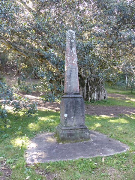
Erected in 1952, the year of Queen Elizabeth II’s succession to the English throne, this memorial takes the form of a sandstone obelisk. It has been there for close to seventy years. The beautiful, weather coloured stone is testament to this. The inscription on one face of the obelisk states: ‘This obelisk was erected as a memorial to the aborigines of the Hawkesbury, for whom this area was originally reserved’.

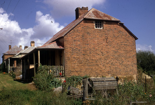
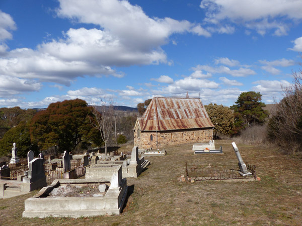
In 1889 the Minister for Lands set aside, or reserved, two areas of land along the Hawkesbury River for indigenous people. The larger of these reserves was on Cumberland Reach and the smaller was on Kent Reach. Together they form one of the numerous river bends. At this time, many indigenous people were still living in the vicinity of Sackville Reach. This explains why these new reserves were collectively named The Sackville Reach Aborigines Reserve. A Christian mission was later established there in August 1901 by the New South Wales Aborigines’ Mission. The Reserve remained for almost sixty years, closing in 1946 due to declining numbers. The area then came under the control of the local shire council.

On 5 July1952, the memorial obelisk was unveiled and dedicated near the site of the old Reserve. Its location had added significance, being not far from where the late Andrew Barber had lived. Mr Barber was described by the Windsor and Richmond Gazette,18 June 1952, as ‘the last of the aborigines of this district’.

The ceremony took place on the one hundred and sixty third anniversary of the day when an exploration party, lead by Governor Arthur Phillip, rowed past there in 1789. Phillip’s party, comprising about forty men, would have required at least three boats. In his journal, Captain John Hunter, a significant member of the group, did not actually state the number of boats used.

In his essay ‘Phillip’s Exploration of the Hawkesbury River’, Alan Dash refers to Jacob Nagle’s memoir. Nagle was an American sailor and crew member of the Sirius. Nagle’s recollection was that two, six-oared cutters accompanied a sixteen-oared vessel, describing the latter as ‘a boat that was built’. Dash concludes from this that the vessel was the Rosehill Packet, the first colonial built boat. But the Rosehill Packet was not launched until later in the year. Also, it would prove to be a difficult vessel to handle and if what Dash states is correct, I am surprised that Hunter did not mention it. Perhaps the larger vessel used was one of the disassembled boats that were brought out from England in cases. It is possible that since the Sirius was being repaired in Sydney at this time, the cutters used were from her complement of three.    

The exploring party had spent the last four days rowing upstream from the mouth of the river at Broken Bay. This was Phillip’s third attempt to find and trace the river’s course.

Hunter commented in his journal that ‘we were all well armed, and capable of making a powerful resistance, in case, as we advanced up the river, we should find the interior parts of the country well inhabited, and the people hostile.’  It was still early days for the new arrivals. The strangeness and unfamiliarity of the country and its inhabitants obviously made the newcomers very wary and suspicious. In keeping with this caution, on this third expedition Phillip increased the number of marines by five. However, as they ventured along the river, they experienced no confronting or threatening behaviour from the few Aborigines they encountered.

Before the memorial obelisk was unveiled and dedicated in 1952, the area around the site was cleared by the Colo Shire Council and a concrete base provided. The memorial could be seen clearly from the river. There was no acknowledgement included on the obelisk that the land had always been occupied by the indigenous people of the Hawkesbury. This was an unfortunate omission, especially when accompanied by the condescending notion of commemorating the reservation of an area for the original inhabitants to occupy. 

However, without the memorial’s existence there would be little way of knowing the area’s significance in indigenous history. The memorial reminds us of this and hopefully has the potential to motivate inquiry and understanding about Aboriginal prior occupation and history in this area. It is significant that the organisers of the obelisk’s unveiling wanted it to occur as precisely as possible to the time and date when Phillip’s exploration party rowed past in 1789.  

The obelisk was the idea of Mr P. W. Gledhill and he generously donated it. The stone was dressed and inscribed using funds from a public subscription.

Born in 1890, Percy Walter Gledhill was a most enthusiastic and dynamic local historian throughout his adult life. He was in the real estate business, having taken over his father’s Newtown agency and lived with his family at Fairlight, near Manly. A popular speaker, he gave many talks on local history subjects, illustrating them with lantern slides. He also wrote local history books and articles, including a variety of church histories. 

A founding member of the Manly, Warringah and Pittwater Historical Society which began in 1924, he was president from 1940 until his death in 1962. He was an active  member of the Royal Australian Historical Society and in 1952 was awarded a Fellowship of the Society. During his life, he was responsible for the creation of a significant number of memorials commemorating historical events, many of them relating to Governor Phillip.

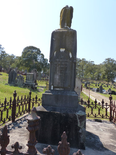
In 1950 Gledhill had been associated with a memorial to specific Aboriginal grave sites in Camperdown Cemetery. This memorial has a far wider application, being seen as ‘a tribute to the whole of the Aboriginal Race’. Gledhill contributed the memorial’s concrete base.

It is only fitting that Gledhill’s achievements have also been commemorated in a number of ways. A lookout over Broken Bay and two waterfalls in Kuring-gai Chase National Park are named after him. He is remembered at Camperdown Cemetery by the Gledhill Gates. For many years he had been chairman of this cemetery’s Trust.

Back in those early post World War Two years, Gledhill’s memorial obelisk at Lower Portland created significant interest. This is evident from the sizeable crowd that attended the ceremony. A large component was made up of Royal Australian Historical Society members. All were prepared to travel to this remote part of Sydney on a very cold and windy afternoon.

The obelisk was unveiled by the President of the Colo Shire Council, Mr H. C. Matheson, and the Anglican Dean of Sydney, the Rev Barton Babbage, performed the dedication. According to the Windsor and Richmond Gazette, 23 July 1952, the former international cricketer ‘Bert’ Oldfield ‘gave an absorbing and at times amusing address on feats of Aboriginal cricketers of the past’. John Anthill, the composer of the Corroboree ballet, and his wife were also in attendance. Their attendance was perhaps an acknowledgement of the importance of cricket and music in the life of the Reserve.

Despite the interest and enthusiasm shown in completing and dedicating the memorial in July 1952, weeds and bush plants began reclaiming the site and with it the obelisk. For a couple of decades the memorial was forgotten, until it was ‘found’ again during a council clean-up of the reserve.

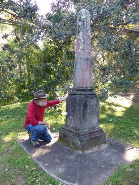
On my initial visit to the obelisk I noticed, despite skilful repairs, that it had at some time been broken. Thanks to the efforts of Michelle Nichols at the Windsor Library, I learnt more about this damage. From the Council Records Department, Michelle discovered that in August 1981 ‘the top half of the obelisk was toppled, possibly by a 4WD vehicle.  It was taken to Council depot for storage until further notice.’ In July 1985, vandals dislodged the top of the obelisk from its base. Later in August that same year, repairs involved repositioning the memorial’s top part by 25mm.

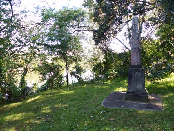
At the time of writing, there is little or no signage to the site. The access track is narrow and uninviting. I wonder if this is to avoid any threat of further vandalism. The obelisk is partially secreted by a large fig tree whose branches and leaves hang down protectively around it. A tangle of weeds restricts a view of the river. It follows that the obelisk cannot be seen from the river. 

A visit to the memorial obelisk is definitely recommended. This is an unusual and unique memorial in a very secretive, bushland setting. The proximity to the Hawkesbury River presents a peaceful and attractive place for genuine reflection on the area’s history. Some strikingly large, lichen stained boulders tower in the bushland behind the obelisk. It is as if they are on sentry duty, there to protect this small, significant beacon of memory which stands upright below them.

© 2017 Jim Low (updated October 2018)


Note:

  • Captain John Hunter’s An Historical Journal, Angus and Robinson, 1968, gives a first-hand account of Governor Phillip’s exploration of the Hawkesbury River.
  • Besides the newspapers of the day, I have Jack Brook to thank for his valued, historical account of the Hawkesbury Aboriginal Reserve and Mission, Shut Out From The World, Deerubbin Press, 1999. It was there that I first read about the memorial.
  • I would also like to acknowledge Tony Dixon’s comprehensive article on Gledhill.
    ( http://www.gledhillgenealogy.info/pwgstory.htm )
  • Alan Dash’s essay ‘Phillip’s Exploration of the Hawkesbury River’ is in Hawkesbury River History, edited by J.Powell and L.Banks, Deerubbin Press, 2011.

On Sacred Ground

While travelling in central western New South Wales last weekend, I took time to visit a couple of old churches. Both churches were in close proximity to their cemeteries. As if not wanting to vacate the church premises altogether when death came calling, the graves of some of the former congregation members cluster literally in the church shadows. I suppose the graves further away from the church probably contained the free thinkers of the parish.

Exploring old churches and cemeteries can become rather addictive. I have previously visited St John’s Anglican Church at Georges Plains, located not far from Bathurst. It had been a quick, late afternoon visit last year and I wanted to return.

Designed by Bathurst based architect Edward Gell, the church was built in 1867. Constructed mainly of rough faced, irregular sized and variously coloured stone blocks, it is a very attractive and interesting looking building. The old, rust stained corrugated roofing sheets are trimmed with delicate, ironwork along the roof line. There is a simple design to the iron cross which hovers kite-like above one end of the church, while being dwarfed by a high, wooden bell tower. The tower’s iron steeple is topped by another finely crafted iron cross. I also noticed a long, thin stone buttress that supports the back wall.

Apparently St John’s has not been used as a church for many years. It is now just an empty shell, with all its internal trappings long removed.

The other church visited, and this one for the first time, is situated at Kirkconnell, between Lithgow and Bathurst.

A modest construction, St Mary’s Roman Catholic Church is made of weatherboard, with a high pitched corrugated iron roof. It hides away along a dirt road that meanders through a forest. The church is surrounded by grave stones, on a large, cleared piece of land. There were two old chairs beside the entrance to the church when I visited. I hope that the next time I am there, I find a local sitting in one of the chairs ready to share with me this old church’s story.

© Jim Low

There Is A Green Hill

© Jim Low

Returning from Victoria in late January 2016, I left the Hume Highway at Coolac and headed up to Cootamundra. Just north from there is the township of Wallendbeen where I noticed a modest, boarded up church. Stopping to take a photograph, I saw that there was no signage to identify the building. Fenced off on a hillside in a paddock, this lonely, discarded little church of local granite stone appeared to have lost its identity and use.

I later discovered that the building had been a Presbyterian church, subscription funded, built in 1882 and closed in 1948. Miles away, under the shadow of the Sydney Harbour Bridge in November 1948, I was baptised at St John the Baptist Church of England in Milsons Point. The realisation that this little church at Wallendbeen had never functioned as a church in my life time, saddened me.

This once valued and loved building, a social and spiritual hub of the area and a significant part of many people’s lives, was now lost in the landscape.

‘They have one of the neatest little churches to be found in any part of a country parish’, the Lithgow Mercury of 5 June 1906 proudly proclaimed about the newly built St Matthews Roman Catholic Church at Lowther. This once thriving area of farmers, graziers and loggers is situated on the road to the Jenolan Caves. Built in 1905, St Matthews Church was opened and consecrated in June the following year.

Erected on stone foundations, this quaint building is comprised of galvanised iron, steel-lined interior and polished New Zealand pine floor boards. It was named after the local priest Father Matthew Hogan, who worked so hard to see it built. Able to seat a congregation of about 100, it replaced an older church which had been moved from Mt Victoria about 35 years previously. In 1906 the parish still owed about half the building cost of 200 pounds. A social dance, at which the ‘Depression Chasers’ Orchestra from Oberon provided the music, was still needed in September 1934 to aid the Church fund.

Church buildings such as those at Wallendbeen and Lowther did not just materialise overnight. Their construction usually required great effort, cost and tireless commitment from their congregations. And they fulfilled a need, for they were wanted. Sometimes all this is forgotten when we stumble on a lovely little church like St Matthews, set in a picturesque location but now is closed and deserted.

The Australian poet Geoff Page begins his Back-road Churches poem with the unequivocal observation:

Out on the back-roads
the churches are dying.

Published back in 1975, we could now justifiably replace ‘dying’ with ‘dead’, for many of these churches are permanently closed or in various stages of ruin. Some survive as private residences or community centres but in doing so have lost their original identity and function. Now we can also include the many churches on the main-roads that, as Page says, ‘strain beneath the wind’ in varying stages of ruin.

In Frank McMahon’s poem Ruined Church – Collector, the poet describes the ‘scatter and decay’ that is present in the ruins of a church between Goulburn and Canberra. He reflects on the final day of worship and ‘how it came to this’. The poem finishes with memorable and powerful images, as the congregation:

‘…left the last to leave to shut
abandoned things behind a pointless door.’

For some time now I have been photographing derelict country churches that I see on my travels. They come in all stages of ruin. I always worry that if I don’t take a photograph, on my next visit it will be too late to do so. A number of times that has sadly been the case.

For those of us who stopped attending church many years ago, these buildings still hold indelible memories. The scripture stories and texts, the choruses, the hymns and the fellowship are not easily forgotten or disregarded.

In 2009 I wrote a song about the disappearance of functioning churches from the Australian landscape. I unintentionally echoed the first line of an old hymn I had learnt as a child. It went:

There is a green hill far away,
Without a city wall,
Where the dear Lord was crucified,
Who died to save us all.

The hymn was written by the Irish writer Cecil Frances Alexander, apparently during the night while nursing her sick daughter. It was published in 1848 in Alexander’s Hymns For Little Children.

In today’s society the role of the established churches do not figure as prominently, if at all, in many people’s lives. But in the past they played a very significant part in the community. They were meeting places and their members were collectively referred to as congregations. They were places of worship, sacred buildings, houses of God where people found sanctuary from life’s tragedies and uncertainties. People experienced the variety of human emotion as lives were informed, influenced, challenged, celebrated, united, comforted, changed and mourned in these buildings.

For some, the churches were places where dogma and inquiry uncomfortably co-existed; where indoctrination and free-thought sometimes inevitably collided. They were places where one’s duty to God and to the state could be severely tested when balanced against taught ideals and the weight of conscience. In times of crises they championed the power of prayer and tested rigorously the faith they nurtured. Whether harvest or drought, birth or death, gain or loss, war or peace, the church was expected to always be there and find some meaning in it all. And now they are quietly vanishing from the landscape, ‘their future … denied’.


© Jim Low
December 2016