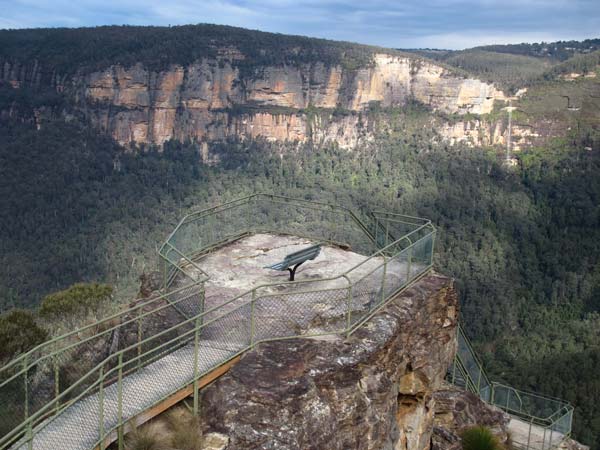
Pulpit Rock is prominent in many of the most dramatic perspectives on the cliff wall landscape of the valleys of the upper Grose River and Govetts Creek. It is easily reached by the Clifftop Track from Govetts Leap or the steps from the unsealed circuit off Hat Hill Road.
[photo: Christine Davies]
One of the things scenery lovers most value about this valley is the changing parade of colours on the Banks Wall and Burramoko Head varieties of Narrabeen sandstone during the course of the day. In neutral light, the places where sandstone has broken away most recently (that may be hundreds of years ago) look white or yellow, the areas less lately exposed look orange and those altered longest ago look grey. But daily variations or cloud cover change the intensity, particularly when the late afternoon sun shines directly on the yellows or oranges just before the soft blackness of the afternoon shadows sweeps up from the valley floor.
© Don Morison